Hiking trail
Red Wine Route Assmannshausen
medium
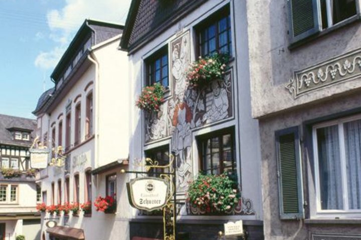
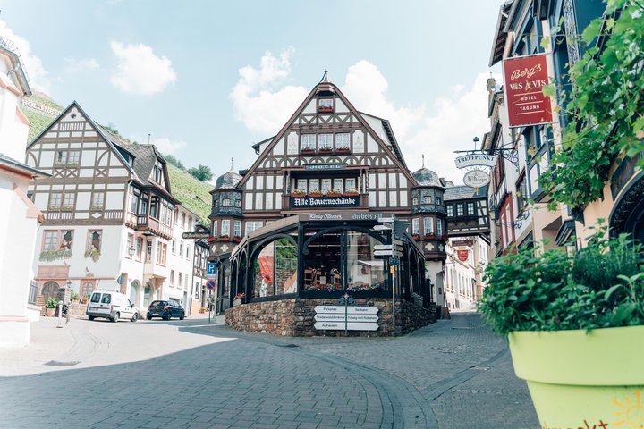
The Red Wine Route starts in Assmannshausen at the church in the town center. The marking points right at the Alte Bauernschänke hotel into Niederwaldstraße. Right at the beginning, the route runs concurrently with the Rheinsteig past the valley station of the chairlift, which leisurely gondolas from the town up to the Niederwald hunting lodge. At first, it goes steep for a short distance, then somewhat flatter uphill to the forest road junction.
You turn sharply right onto it and walk straight ahead into the forest at the following left bend of the road. After about 100 meters, there is a sharp left turn; a few meters away is a viewing pavilion with a view of the Assmannshäuser Höllenberg. Its name has nothing to do with the devil, but derives from the Middle High German word "helda," which described a steep slope. And steep, as you can see at first glance, it definitely is on both sides. The reason the wines from the Höllenberg taste so "devilishly" good is the slate soil, the steep incline of the slope, and its orientation to the south and southwest.
After enjoying the view, the path continues steeply uphill. Above, there are two hairpin bends before the chairlift's mountain station is reached. The small wildlife park belongs to the Niederwald hunting lodge, the "germ cell" of the Ostein landscape park. In 1764, Karl Maximilian Count Amor von Ostein had a hunting house built here for his guests and began transforming the entire Niederwald plateau up to the Niederwald Monument (which was inaugurated only 74 years after his death) into the first landscape park on the Rhine.
At the mountain station, we do not go half-left to the hunting lodge but instead orient ourselves half-right along the wildlife fence. At its end, the marking points down to the right. The route follows the forest path steadily downhill. At the border between forest and vineyards, it turns sharply right and now leads through several switchbacks on paved service roads into the Assmannshäuser Frankenthal vineyards.
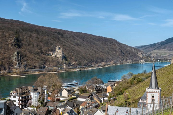
In the lowest right curve, a magnificent panorama suddenly opens up. The Rhine gurgles through the descent of the Binger Loch, where it has its highest flow speed of 14 kilometers per hour on its way from the source in the Swiss Graubünden to the sea. In the curve, it is worth turning around and looking directly at the rock spur: the plates, which were once horizontally layered millions of years ago, were tilted vertically by massive tectonic shifts. The phenomenon, which occurs openly in many places in the Upper Middle Rhine Valley (e.g., the Loreley), indicates that the Rhenish Slate Mountains (like the Himalayas and the Alps) are a geologically young fold mountain range.
The service road leads downhill with a beautiful view of Assmannshausen to the edge of the town near the former elementary school. From here, 200 steps lead down left into the village. The staircase, which squeezes through between the houses at the end, ends at the Niederwaldstraße by the church. The route turns left onto it and first leads to the railway crossing and then continues towards the Rhine.
At the promenade, you turn right and stroll along the hotels and restaurants to the junction of the street "Am alten Rathaus." Along the way, you pass the venerable Hotel Krone, the oldest inn in the town. Before tourists discovered the Rhine Valley, boatmen here changed their horses. Since the early 19th century, famous travelers have stayed in the hotel. The Ferdinand Freiligrath Museum Room in the hotel commemorates the poet, who wrote his "Creed" in the Krone in 1844.
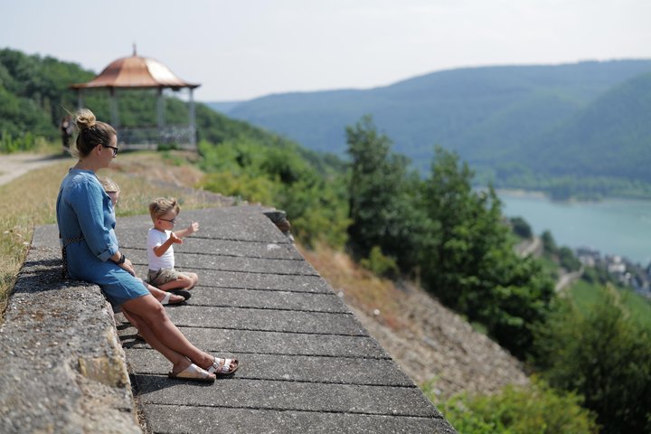
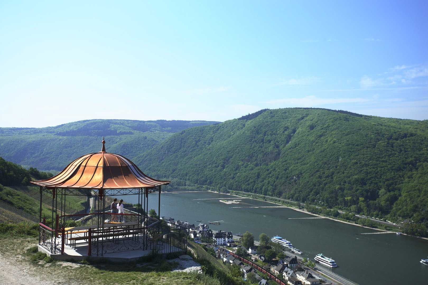
The route turns right onto the street "Am alten Rathaus," passes under the railway line, and immediately behind it turns left into "Lorcher Straße." From its end, the path ascends steadily uphill in five bends through the Höllenberg. Further up, there is the option to briefly detour to the Red Wine Arbor. The detour (just under 100 meters) rewards with one of the most magnificent panoramic views in the entire Middle Rhine Valley—and a depot where chilled wine awaits hikers. The cozy pavilion with the distinctive copper roof is a relic from Margarethe von Trotta's film "I'm the Other" with Katja Riemann and Armin Mueller-Stahl from 2006. After filming, it was supposed to be mothballed, but dedicated locals ensured it was given a new permanent place a few meters above its filming location.
At the junction to the Red Wine Arbor, the path splits. The main path leads left uphill to a small forest patch. From there, it follows the service road along the vineyards of the Hinterkirch site towards Aulhausen until it meets the access path to the Rheingau Monastery Trail. Here, the marking points down to the right and guides back down into the Höllenberg. At the large lettering on the vineyard wall, the view opens again into the Rhine Valley; the castles Rheinstein and Reichenstein greet from the opposite bank. The Red Wine Route then descends together with the Rheinsteig and Monastery Trail back to the starting point. Those who want to skip the Hinterkirch detour can head directly towards Assmannshausen from the junction to the Red Wine Arbor and rejoin the main path further down.
Upon arriving in town, one has rightly earned a vintner’s snack in one of the inns and restaurants.
Impressions


Start of the Tour
Assmannshausen church
More Information
- round tour
- refreshment stop
- auspicious
Hiking parking lot Höllenbergstraße
Responsible for this content

WIESBADEN RHEINGAU
·
Michael Ruff